
Construction Survey Control for Subdivisions Expanding Beyond Established Streets
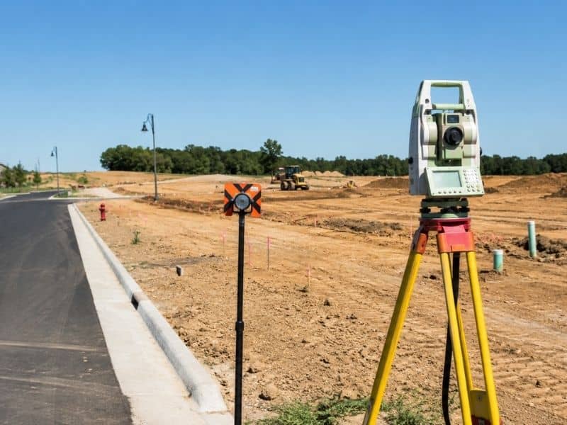
Construction survey control is what keeps a growing subdivision from drifting out of line as it pushes past the last paved street. When crews build roads, set lot corners and lay pipes on raw land, they all measure from the same set of reference points. Those points carry known positions and heights, and every stake in the ground depends on them. Extend that control poorly, and the new streets may not meet the old ones.
Extending Control from Existing Infrastructure into Undeveloped Land
Control has to travel from finished streets out into open ground before any building starts. Crews tie into existing points along the current pavement and utility system, then carry those positions forward into land that has no roads yet. The known part of town becomes the anchor for the unknown part.
Every new reference gets checked against the last so small errors don’t pile up over distance. A tiny slip near the road grows into a large one a half-mile out if nobody catches it. Careful measurement at each step keeps the chain tight.
Done right, this chain links the fresh work back to the established part of town. The new streets will line up with the ones already there, and the utilities will connect where they should. A weak link, on the other hand, shows up as a road that misses its intended junction.
Selecting Control Locations That Can Survive Mass Grading
A control point is worthless if a bulldozer wipes it out in week one. Mass grading moves huge amounts of dirt across a subdivision, so crews place their key references outside the cut-and-fill zones. Ground that will stay put through construction is the goal.
They also pick spots with clear sight lines and easy access, protected from heavy equipment by distance or barriers. A point a crew can see but a machine can’t reach strikes the right balance. Location choices like these decide whether the network lasts.
A poor choice costs real time. A point buried under a new fill slope or scraped away during grading forces a costly redo. Smart placement up front keeps the network alive through the messiest phase of the job.
Relating Road Geometry to Lot and Utility Layout
Every part of a subdivision shares one coordinate system so the pieces fit together. Road centerlines, curve data and stationing set the frame, while lot corners, sanitary lines and storm pipes all reference the same control. Nothing stands on its own basis.
This shared system lets the crew stake a manhole and a lot corner knowing the two relate correctly on the ground. A pipe planned to run under the street actually lands there. The layout holds together because every element traces back to the same source.
When that discipline slips, the errors are expensive. A utility set on its own basis can end up under a future garage instead of the road. Tight, shared control is what keeps those clashes from happening.
Detecting Control Disturbance Before Layout Continues
A disturbed control point can quietly throw off everything staked after it, so crews test their references often. They shoot check shots to known points, take independent backsights and run benchmark loops to confirm the numbers still hold. These checks take only minutes.
When a reading comes back off, work stops until the crew finds out whether a point moved. A stake or a marker knocked by equipment can shift just enough to matter without looking disturbed. Stopping to verify beats trusting a number that has quietly gone wrong.
The payoff shows up in avoided rework. Catching a bad point early beats discovering a curb set two inches off after the concrete cures. A quick check costs minutes, while a missed error can cost days.
Maintaining Continuity as New Subdivision Phases Open
Big subdivisions open in phases over months or years, and the control has to carry through all of them. As one phase wraps and the next begins, crews transfer the network forward and update their records. Old points get rechecked, since time and weather can move them.
New contractors often join along the way, which raises the stakes for clear documentation. A shared, well-recorded coordinate basis keeps everyone measuring from the same source. Without it, each new crew risks drifting onto its own numbers.
As-built checks then confirm the finished work matches the plan before the next phase ties in. That confirmation catches trouble while it is still fixable. This steady hand-off is what lets phase four connect cleanly back to phase one.
Frequently Asked Questions
How many control points does a subdivision project need?
There is no fixed number, since it depends on the site’s size, shape and how much sight line the terrain allows. A crew sets enough points that layout work always has a couple of known references within reach, plus extras for backup. Flat, open land needs fewer than a wooded or hilly site. The aim is dependable coverage, not a set count.
What happens when a construction control point is destroyed?
The crew re-establishes it from the surviving points in the network. Because good control carries built-in redundancy, losing one point usually does not stop work as long as others remain. The surveyor measures a replacement, ties it to the same system and documents the change. Trouble only starts when too many points vanish at once.
Can different contractors establish their own coordinate systems?
They can, but on a shared project it invites problems. If a grading crew and a utility crew each use their own basis, their work may not line up where the two meet. One agreed coordinate system for the whole site prevents that. The surveyor usually sets and controls it so every contractor measures from the same source.
