
Karst Survey Mapping Before Commercial Site Expansion in Clarksville
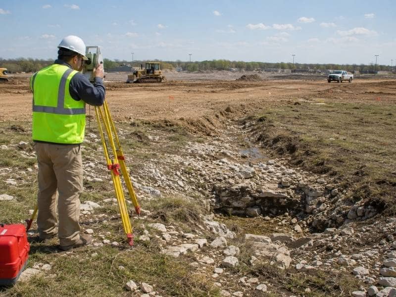
A karst survey is a smart first step before you expand a commercial site over rocky, cave-prone ground. Karst country is where sinkholes and hidden voids can lurk beneath the surface. Before you add buildings or pavement, you want to know where the visible warning signs are.
A karst survey maps depressions, openings, and drainage paths so the design team can plan with care. That early mapping helps protect the expansion from problems that start below your feet. It also gives your engineers the base they need to study the site further. On karst ground, what you cannot see can cost you plenty.
Gather What Is Already Known
Good field work starts with good background research first. Available maps, environmental records, prior site reports, and owner observations can all guide the investigation. Each source hints at where karst features might appear on the site. The surveyor uses them to focus the field effort where it counts most.
Starting informed beats searching blind across the whole property. An old report might note a sinkhole that filled in years ago. The owner might recall a spot that always drains oddly after heavy rain.
Those clues point the survey toward the likely trouble areas quickly. Then the field work confirms and maps what is really there. Research first saves time and sharpens the whole survey.
Locate the Visible Features
Karst leaves clues on the surface for a trained observer. Recording their position, size, and elevation builds a clear picture of the site’s character. The survey maps several visible features:
- Sinkhole-like depressions: signal a possible path to a void below.
- Rock exposures: hint at the geology hidden underneath.
- Disappearing drainage: shows where water may run to a void.
- Surface openings: mark spots where the ground gives way.
These features tell the team where the ground may behave in unusual ways. Mapping them is the heart of a karst survey and its main value. A depression that swallows runoff signals a possible path to a void below. An exposed rock face can hint at the geology hidden underneath.
The surveyor records each feature precisely for the team to study. That detailed map becomes the foundation for careful planning ahead. Every mapped feature is one less surprise waiting during construction.
Connect the Features to the Expansion
Locating the features is only useful if you tie them to the plan. The survey base lets engineers compare visible karst features against proposed buildings, pavement, utilities, and grading limits. That overlay shows where the design meets risky ground directly. From there, the team can adjust the layout or study those areas further.
The connection turns raw mapping into real planning for the expansion. A building pad planned right over a depression deserves a second look. The overlay makes that conflict obvious to everyone on the team.
Then the team can move the pad or investigate the ground beneath it. That link between features and design protects the whole project. Mapping alone is useful, but connecting it to the plan is where it pays off.
Coordinate With Geotechnical Work
Surveyors and geotechnical experts play different but related roles. The surveyor measures locations and elevations with real precision. Geologists and geotechnical engineers then evaluate subsurface conditions and engineering risk. Together, they build a fuller understanding than either could reach alone.
Clear coordination keeps each professional in their lane while sharing one accurate base. The survey provides the map, and the geotechnical team provides the analysis. Neither one can safely do the other’s job on a karst site.
So they work side by side throughout the investigation. That teamwork gives the owner a complete and trustworthy picture. On tricky ground, that partnership is exactly what keeps the project safe.
Keep Control for Future Testing
A karst site often needs more study over time, not just once. So the surveyor sets reliable control that later work can share freely. Test locations, borings, monitoring points, revised designs, and construction can all reference the same spatial framework. That consistency keeps every step tied to the same accurate map.
It saves confusion as the project moves from study to design to build. A boring located off the shared control could mislead the whole team. Consistent control prevents that kind of costly error entirely.
Every future test builds on the same reliable base you set today. So the control the surveyor sets now serves the project for years. One good framework keeps a long investigation honest.
Frequently Asked Questions
Can a land survey confirm whether an underground void exists?
Not on its own, no. A surface survey maps what is visible, but it cannot confirm hidden subsurface conditions. Confirming a void usually takes geotechnical or geophysical investigation to be sure. The survey and those studies work best together as a team.
Should visible depressions be mapped even when they are dry?
Yes, dry depressions still matter a great deal. Their position, size, and elevation can be important to the project team even without standing water. A dry depression today might behave very differently after heavy rain. So mapping it keeps the record complete and useful.
Who determines whether construction can proceed near a sinkhole?
That call involves several professionals working together. Engineers, geologists, reviewing agencies, and owners may all weigh in using multiple sources of information. The survey supplies part of the picture, not the final decision. Bringing the right professionals together leads to a sound and safe answer.
