
Boundary Evidence on Land Once Divided from Farms and Large Rural Tracts
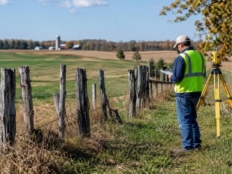
Boundary evidence on land carved out of an old farm rarely fits neatly inside the smaller deed alone. A ten-acre lot sold off a two-hundred-acre tract borrows its lines, its corners and often its confusion from the parent property. To read that lot correctly, a surveyor has to look back at the bigger piece it came from and the way it was first divided. The clues sit in old deeds, worn fence lines and features that may have shifted or disappeared.
Tracing the Parent Tract Before Studying the Smaller Parcel
A small rural parcel makes far more sense once you study the land it was cut from. The parent tract holds the original corners and the first divisions, and later deeds simply reference those. Read alone, the small deed leaves out half the story.
So a surveyor pulls the earlier records before worrying about the current lot. They build a picture of how the whole farm was split over time, one sale at a time. That picture explains where the small parcel’s lines really come from.
A line that seems random on the small deed often matches a fence or road that once divided the original farm. Seen against the parent tract, it turns from a puzzle into a pattern. Starting big and working down keeps the reading honest.
Interpreting Calls to Trees, Roads, Creeks and Former Owners
Old farm deeds describe boundaries using whatever stood there at the time. A line might run to a large oak, along a wagon road, down the center of a creek or to a corner shared with a neighbor named in the text. These calls made sense to the people who walked the land.
Time, though, is hard on this kind of description. Trees fall, roads move, creeks shift their banks and owners change hands and names. A call that once pointed to something obvious can point to nothing at all.
A surveyor investigates each reference, searching for the tree stump, the old roadbed or a deed from the named neighbor. Reading these clues correctly often decides where the true line sits. Two people can study the same worn deed and picture very different corners, so the search has to be thorough.
Evaluating Old Fence Rows Without Treating Them as Automatic Boundaries
A fence is evidence, but it does not prove a property line on its own. Farm fences went up to hold livestock or mark a field, and their builders rarely cared about the exact deed line. A fence can sit near the boundary or well off it.
So a surveyor studies each fence with a careful eye. They note its age, how well it was kept and whether it matches the record and the corners found nearby. An old fence that lines up with deed calls and long use carries real weight.
One thrown up for convenience is a different matter. A fence built to dodge a wet spot or follow a slope may sit far from the true boundary. Treating that kind of fence as gospel would be a mistake, so the surveyor weighs it against everything else.
Solving Irregular Remainders Left by Multiple Conveyances
When a farm gets sold off in pieces over many years, odd leftovers tend to appear. One deed excepts a few acres, another overlaps a neighbor’s description and a residual chunk may never get its own clear deed at all. These pieces can muddy who owns what.
A surveyor untangles them by laying each conveyance next to the others. Where the descriptions agree, the picture is simple, and where they clash, the work begins. Gaps and double-covered ground both show up in this side-by-side reading.
Only after that comparison does the true shape of the remaining land come clear. The remainder is whatever is left once every sale is accounted for. Getting that shape right is often the hardest part of a farm-division survey.
Establishing Defensible Corners from the Full Evidence Record
A final corner has to stand on the whole body of evidence, not one convenient clue. The surveyor weighs the deed calls, the physical marks found, the fences and any adjoining surveys. Each source gets its due before any decision is made.
Professional judgment guides the final call, since the evidence rarely agrees perfectly. One clue points one way while another points slightly off, and the surveyor decides which carries more weight. That reasoning is the heart of the work.
Good documentation records what was found, what controlled the decision and why. A corner set and explained this way can hold up if a neighbor or a court ever questions it. Standing behind the result is the whole aim of a careful boundary survey.
