
How Construction Survey Benchmarks Keep Roads, Sewers, and Drainage Systems Aligned
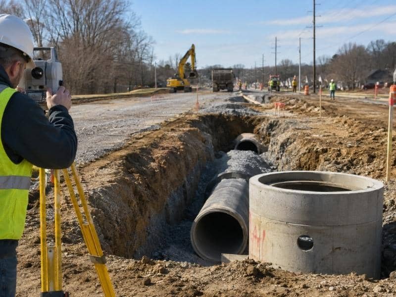
Construction survey benchmarks are the reason a gravity sewer built by one crew connects properly to a road built by another. Infrastructure work runs on elevations more than on anything else. A pipe has to fall a certain amount per hundred feet. A road has to shed water toward an inlet. A manhole has to sit at a height that matches the pipes on both sides. All of those numbers come from a shared set of vertical reference points. When those points are solid, the pieces line up. When they aren’t, the problems appear underground where they cost the most to fix.
Choosing Stable Locations for Project Benchmarks
A benchmark only works if it doesn’t move. Surveyors set them on ground that construction won’t touch, which usually means outside the grading limits and away from haul roads. Common choices include a spike in a mature tree well off the work area, a chiseled mark on an existing concrete headwall, or a rod driven deep enough to sit below frost.
Spacing follows the work. On a long infrastructure job, crews need a benchmark close enough to reach without running a long line of levels every day. Setting several along the project keeps daily checks quick. It also means losing one doesn’t stop anyone.
Description quality decides whether a benchmark gets used. A note reading “spike in pole” helps nobody a year later. A useful description names the object, gives a measured tie to something permanent, includes a photo, and states the elevation and the datum it came from.
Transferring Elevations Across the Entire Infrastructure Site
Elevation gets carried across a site by running levels between known points. A crew starts at a benchmark, works down the project, and returns to a known point to close the loop. The difference between the starting elevation and the closing elevation is the error. A small error gets distributed across the run. A large one means something’s wrong and the crew runs it again.
That loop check is the whole safeguard. Without it, a crew can carry a mistake for half a mile and never know. Infrastructure projects stretch far enough that a single bad reading early in the day affects everything set afterward.
Different crews need the same starting point. A utility contractor working the north end and a paving contractor working the south end have to use benchmarks from the same network. Mixing in an old benchmark from a previous project, set on a different datum, produces two sets of correct-looking numbers that disagree by a foot.
Checking Sewer Slopes and Manhole Invert Elevations
Gravity sewer carries the tightest elevation requirements on most projects. A line might fall four tenths of a foot per hundred feet. Build it flatter and solids settle in the pipe. Build it steeper and flow outruns the solids, which causes the same problem. Crews set grades for each pipe run and check the invert at both ends.
Manhole inverts get measured directly. The surveyor drops a rod into the structure and reads the elevation at the pipe openings. Those readings get compared against the design. A structure set two tenths high can back water up into the run behind it.
Timing matters as much as accuracy. Checking a pipe run while the trench is open costs an hour. Checking it after backfill, paving and restoration costs a great deal more. Crews measure as each segment finishes, not at the end of the project.
Coordinating Road Grades With Storm Drainage
Roads and storm systems have to be built from one set of elevations. Pavement sheds water toward the gutter. The gutter carries it to an inlet. The inlet drops it into a pipe that runs to an outfall. Every step in that chain depends on the one before it.
Inlet placement is where mistakes show. An inlet set slightly high leaves a low spot in the gutter that ponds water after every rain. Crews check the inlet throat elevation against the surrounding gutter grades before the pour, then verify the finished work afterward.
Crown and cross slope get the same treatment. Surveyors set grade stakes along the road at regular intervals and check the finished surface against design. On a wide roadway, a small error in cross slope moves water the wrong direction across an entire lane.
Documenting the Final Infrastructure Network
As-built elevations close out the job. Crews record the finished rim and invert of every structure, the top of pipe at crossings, the finished pavement at regular stations, and the elevations of outfalls and headwalls. Those numbers get compared against the design and delivered to the owner.
The record has a long life. Ten years from now, an engineer designing a connection to this system will pull those inverts and design from them. A utility crew will use them to find a pipe. Accurate as-built elevations save both of those people a field visit.
Datum information belongs in the record too. An elevation with no stated datum is only half useful. Noting the vertical datum, the benchmark used and the date measured lets the next person tie into the work with confidence.
