
Lot Survey Research for Vacant Property With Conflicting Legal Descriptions
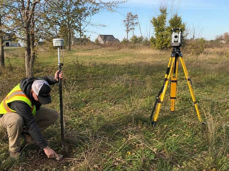
Lot survey research does patient detective work when a vacant property comes with conflicting legal descriptions. Empty parcels often carry a messy paper trail, with deeds and plats that do not quite agree. Before you buy or build, those conflicts need sorting so you know what you actually own.
A survey gathers every description, finds the disagreements, and weighs the evidence on the ground. That careful process turns a confusing bundle of records into a boundary you can trust. It can also spare you a nasty dispute with a neighbor down the road. On a vacant lot, the paperwork is often the whole battle.
Collect Every Description of the Parcel
Conflicts hide across many different documents. Gathering all of them puts the full puzzle on the table at once. Each of these may describe the property a little differently:
- Deeds: the written descriptions of who owns what.
- Plats: mapped versions of the lot and its lines.
- Tax records: another version of the parcel’s extent.
- Prior surveys: earlier measures taken on the boundary.
- Estate and adjoining records: clues from surrounding ownership.
Missing one piece can leave a key clue out of reach during the analysis. So the research begins by pulling together every version of the parcel available. A vacant lot may have sat unused for decades, collecting odd records. Each document adds a piece to the boundary story over time.
Only with all of them can the surveyor see the whole picture clearly. That thorough collection is the first real step toward clarity. You cannot solve a puzzle while pieces are still missing.
Find Where the Descriptions Disagree
Once collected, the documents rarely match perfectly with one another. Distances, bearings, acreage, lot numbers, and point-of-beginning references can all conflict. Sometimes a call is simply left out of one description entirely. The surveyor pinpoints exactly where the records diverge from each other.
Naming the conflicts clearly is the first step toward resolving them properly. A deed might say two hundred feet where a plat says one ninety instead. That kind of gap can move a boundary by a real and costly distance.
The surveyor flags each disagreement for careful study and comparison. Knowing exactly where the records clash focuses the whole investigation. A clear list of conflicts is far easier to solve than a vague sense of trouble.
Search for Monuments and Field Evidence
Paper alone cannot settle a boundary dispute. Surveyors hunt for pipes, rebars, stones, fences, and occupation lines out on the ground. Road evidence and other physical clues count toward the answer too. These markers often carry more weight than a mismatched deed on paper.
Finding them ties the written records to the real world at last. An old iron pipe set by a past surveyor can anchor the true corner. A long-standing fence may mark where owners always understood the line.
The surveyor weighs this physical evidence carefully against the records. It often holds the key that the documents alone cannot provide. The ground itself frequently tells the truest part of the story.
Reconcile the Records With the Site
Sorting a conflict takes real professional judgment, not just measurement. The surveyor compares documents, monuments, neighboring boundaries, and field observations together. They do not simply pick the description that is easiest or most convenient. Instead, they weigh all the evidence to reach a defensible, well-reasoned line.
That analysis is what makes the final result reliable and trustworthy. Surveying law and long practice guide how the evidence gets weighed. A trained surveyor knows which clues usually control a boundary decision.
Applying that judgment turns conflicting records into one sound conclusion. This careful reconciliation is the heart of the whole job. Good judgment is what separates a real answer from a guess.
Present the Issues Clearly
Not every conflict resolves cleanly, and honesty matters most here. The survey documents its findings for the owner, buyer, attorney, or title professional. Where more corrective work is needed, it says so plainly and directly. Clear reporting lets the right parties decide the next step with full knowledge.
That transparency protects everyone before development or sale moves forward. Hiding an unresolved issue would only create a bigger problem later. A good survey lays out both what is settled and what is not.
That candor helps the buyer make a sound decision with open eyes. In the end, clear information is the survey’s most valuable product. An honest report today prevents a courtroom tomorrow.
Protect the Parcel for Future Use
A settled boundary keeps its value long after the research is done. Future owners and builders will rely on the same clear record. That saves them from repeating the costly detective work all over again. A vacant lot with a trustworthy survey is far easier to develop.
It gives a buyer confidence about exactly what they are purchasing. That confidence can smooth a sale and support a fair price. So the research protects the parcel for years to come. It turns a confusing history into a solid foundation for the future.
Keeping the survey record safe is a small but wise step. One good study can serve many owners over time. It also helps if the land finally gets built down the road. Clear boundaries today are a gift to whoever comes next. They spare future owners the same long search you went through. That lasting clarity is the real reward of careful research. A settled boundary turns a risky vacant lot into a property people can rely on. That trust is exactly what a buyer or builder needs before they commit.
