↓
 

Clarksville Land Surveying

Local Land Surveyors in Clarksville, TN

Clarksville Land Surveying
(931) 263-1410
Clarksville Land Surveying
  • Home
  • ALTA Survey
    • Bowling Green, KY
    • Clarksville, TN
    • Jackson, MS
    • Jackson, TN
    • Lexington, KY
    • Louisville, KY
    • Memphis, TN
  • Boundary Surveying
  • Construction Survey
  • Drone LiDAR Mapping
  • Elevation Certificate
  • Land Surveying
  • Topographic Survey
  • About Us
  • Blog
  • Contact Us
Home - Page 2 << 1 2 3 4 … 7 8 >>

Post navigation

← Older posts
Newer posts →

The Ground You Cannot See Can Still Shape a Project, Which Is Why LiDAR Mapping Matters 

Clarksville Land Surveying Posted on June 24, 2026 by ClarksvilleSurveyorJune 25, 2026
Survey professional operating a drone to collect LiDAR mapping data for terrain analysis on undeveloped land.

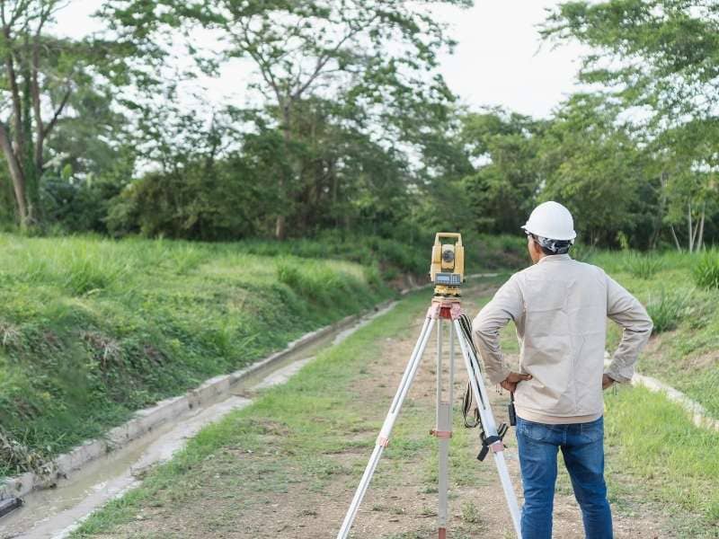
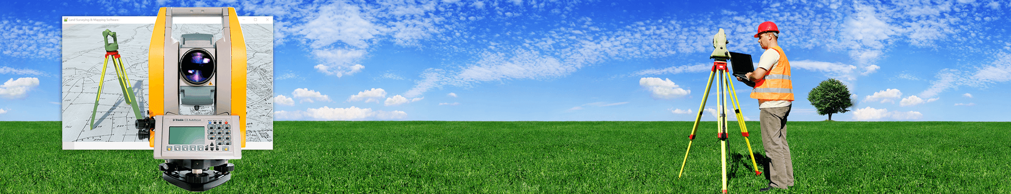
Every piece of land tells a story, but some stories are written in a secret language. You can walk across a large field and feel like you know it well. You see the green grass, the trees, and the flat spaces. However, the human eye often misses tiny dips and rises that can change everything when you decide to build. That is why professional teams use a special technology called LiDAR mapping to study the ground. This tool uses light beams from an airplane or a drone to build a perfect map of the dirt below. It helps people see the hidden shape of the land before they spend money on a major project.

Understanding the hidden shape of the land is the first step toward a successful build. If you plan to build a house, a long driveway, or even a simple park, you need to know exactly how the dirt moves. A small mistake in how you view the property can lead to big problems later. Using advanced tools early in the process makes planning simpler and safer. Here is how special laser tools reveal the secrets of the ground and help people make smart choices.

Subtle Changes in Elevation Can Influence Drainage More Than People Realize

Water always finds the lowest point on a piece of property, even if that point is only an inch deep. When rain falls on a large lot, it follows tiny paths carved into the dirt over many years. A site visit might not reveal these little trails because grass and leaves hide them from view. If you build a structure right in the middle of a hidden depression, water will eventually pool around the foundation.

Laser mapping solves this mystery by sending millions of light beams down to the ground every single second. These beams bounce back to a sensor and measure the exact height of the dirt. This process creates a highly accurate picture of the property contours. Planners can look at this data to see exactly where water will travel during a heavy storm. Knowing these paths helps designers choose the best spots for buildings so the ground stays dry and stable.

Hidden Terrain Features Can Affect Where Roads, Buildings, and Utilities Belong

The overall layout of a development project depends entirely on the stability of the surface. Rough ground can have hidden gullies, steep slopes, or buried ridges that you cannot easily spot from the edge of the property. If an engineer places a road over a hidden dip, the pavement might crack or sink over time. Moving heavy utility pipes around these unexpected bumps can become very expensive if you discover them too late.

  • Natural gullies: Deep paths where soil has washed away over time.
  • Hidden ridges: Long, raised strips of land that can block paths or pipes.
  • Uneven slopes: Areas where the ground tilts unexpectedly, making building difficult.

Using laser measurements allows teams to see through the clutter and map every single bump. Engineers can rotate these digital models on a computer screen to view the property from every angle. This accurate view ensures that roads follow the natural shape of the land, which reduces the need to move large amounts of dirt. It also helps crews place water lines and electrical cables in areas where the ground is predictable.

Large Properties Often Reveal Different Patterns When Viewed Through LiDAR Mapping

Walking across fifty or one hundred acres of land takes a long time, and it is easy to get lost in the details. From the ground, you can only see a small section of the property at one time. This limited view makes it hard to see how a hill on one side of the land affects a low spot on the other side. Laser data fixes this problem by gathering information across the entire boundary in a single flight.

This technology creates a broad model that shows the grand patterns of the entire acreage. Planners can see how different sections of the piece connect to one another, which reveals long-term trends in the landscape. For example, a model might show that three separate hills all drain into one central valley. Understanding these large connections allows owners to divide the property wisely or preserve natural areas that keep the land healthy.

Land That Appears Flat May Contain Important Surface Variations

A piece of land can look as flat as a tabletop when you look at it from a car window. However, true flat land is very rare in nature, and most level lots have gentle waves across the surface. These small variations are hard to see with the naked eye, but they still dictate how dirt moves during a grading project. If a builder assumes a lot is perfectly flat, they might face surprises when they try to level the area for a foundation.

Relying on a quick look around a property is rarely enough for serious development planning. A small drop of just a few inches over a long distance can alter how a flat yard handles water. Laser maps catch these tiny shifts easily, providing a clear map of the actual surface. This data gives planners the exact details they need to shape the yard correctly so that water flows away from future improvements.

Better Terrain Information Supports Smarter Long-Term Planning

Smart planning is all about looking forward to what a piece of land might become in five or ten years. An owner might want to start with one building today, but they may want to add more structures or longer access roads later. If you do not understand the terrain from the very beginning, your early choices might ruin your future plans. Having precise data at the start gives you the freedom to expand without running into major geographic roadblocks.

This early clarity allows a project to adapt smoothly as goals change over time. Designers can use the original elevation model to sketch out new ideas, test stormwater solutions, and find the safest paths for future traffic. It provides a solid foundation of knowledge that keeps a property useful for decades, ensuring that every new addition fits perfectly with the original ground.

Frequently Asked Questions

What is LiDAR mapping used for?

LiDAR mapping is used to collect detailed elevation and terrain information that supports planning, engineering, and land development projects.

Can LiDAR mapping identify changes in ground elevation?

Yes. LiDAR mapping provides highly detailed information about slopes, contours, and other variations in the terrain.

Why is terrain information important before development begins?

Understanding the shape of the land helps owners and design professionals make informed decisions about site layout and future improvements.

Is LiDAR mapping useful for large properties?

Yes. LiDAR mapping allows owners and planners to evaluate extensive areas more efficiently and understand how different sections of the property relate to one another.

Who benefits from LiDAR mapping services?

Developers, engineers, builders, commercial property owners, land buyers, and other professionals use LiDAR mapping to better understand site conditions before making decisions.

Posted in LiDAR Mapping | Tagged LiDAR Mapping

Planning a New Home on a Wooded Lot? Why Accurate Ground Data Matters More Than Tree Coverage

Clarksville Land Surveying Posted on June 19, 2026 by ClarksvilleSurveyorJune 26, 2026
Drone mapping specialist gathering terrain data to evaluate ground conditions beneath tree coverage before planning a new home.

A wooded lot looks great on a Saturday afternoon walkthrough. The trees are tall, the light filters through the canopy, and the whole thing feels private and peaceful. But what you can see during a tour and what’s actually going on at ground level are two different things. On a wooded lot, what’s beneath the trees matters more than how the property looks on a nice day.

Why Tree Coverage Can Hide Critical Site Conditions Beneath the Surface

Trees are good at hiding problems. Dense woods can cover steep slopes, shallow rock just below the surface, and low spots that hold water after rain. None of that shows up during a walk through a nice-looking stand of timber.

Rock close to the surface is a real cost issue. Blasting or breaking rock during digging can add tens of thousands of dollars to a project. How deep it goes and how wide it spreads determines how bad the bill gets. A site that looks like flat, open woods might be sitting on a rock shelf that makes the whole foundation expensive.

Uneven ground is the other common surprise. A building pad that looks usable from a distance might need a lot of cut-and-fill work to get level. When that cost wasn’t included in the original budget, it causes problems at the worst possible time.

The trees themselves aren’t the issue. The problem is that buyers and designers sometimes make site choices based on what they can see above ground. What the land is doing underneath is a different story.

How LiDAR Mapping Creates a Clear View of the Ground Below the Canopy

LiDAR mapping sends laser pulses from aircraft toward the ground. Some of those pulses pass through gaps in the tree canopy and bounce back from the actual soil surface below. Enough of those returns combine into a detailed ground map, minus the visual noise that trees create.

On a heavily wooded lot, this changes what you know about the property. The model shows ridges, slopes, low spots, and drainage paths that you can’t see from the ground. A homeowner looking at that model can clearly see, with real numbers, how the ground actually lays across the whole lot.

ASPRS data shows LiDAR systems can hit within 15 centimeters of vertical accuracy even under dense forest canopy. That’s plenty precise for choosing a home site and planning a driveway.

The ground model also stays useful as the project moves forward. Architects, engineers, and site planners all work from the same data. That cuts down on disagreements about what the ground is actually doing.

Selecting the Best Home Site Based on Terrain Rather Than Appearance

The most attractive spot on a wooded lot isn’t always the best place to build. A natural clearing might look like the easy choice because it needs less work. That logic skips a step, though.

Clearings often sit in low spots. Low spots collect water. A house built in a low spot faces water issues that don’t go away once the home is done. Grading can help, but fighting the natural lay of the land costs money and rarely fixes it fully.

Ground data lets a homeowner and designer pick a building spot based on slope, drainage, and road access. How pretty the spot looks stops being the main factor. A spot needing more clearing can still be the right pick if the ground drains well and the road connection works.

The National Association of Home Builders links poor site selection on sloped or wet lots to disputes and repair costs after construction. Getting the site choice right from the start avoids all of that.

Using Accurate Terrain Data to Plan Driveways, Utilities, and Site Access

A driveway on a wooded lot has to follow the land, not fight it. Steep grades, sharp drops, and wet areas all raise construction costs and make the driveway harder to use year-round. Knowing where those conditions are before design starts gives the team better options.

The same goes for utility lines. Underground lines have to dodge rock, stay at the right depth, and reach the house without going too far. A ground model shows where those paths work and where they hit problems.

Septic systems are especially tied to ground conditions. Most health departments set minimum distances from property lines, wells, and water areas. The soil also has to drain at the right rate for the system to work. Ground data helps find areas that stay dry enough and drain at a rate that will pass the required soil test.

Working out these choices before clearing starts is much cheaper than hitting a problem halfway through and starting over.

Reducing Clearing Costs and Preserving More Trees Through Better Planning

Accurate ground data has a benefit most people don’t think about: it protects trees. Real ground data keeps the disturbed area smaller and better defined when the building site, driveway, and utility paths get planned.

Without that data, clearing spreads wider than it needs to. Nobody knows where the pad goes or how the driveway runs, so crews clear extra space just in case. That extra buffer takes down trees that didn’t need to go.

A Journal of Arboriculture study found that projects with detailed pre-clearing plans took down far fewer trees. Projects without defined layouts cleared much more. Fewer trees down means lower cleanup costs and a finished property that still feels like the wooded lot you bought.

Ground data doesn’t remove the need for clearing. But it gives the people deciding what to clear enough information to make good choices.

Frequently Asked Questions

What is LiDAR mapping and why is it useful on wooded lots?

LiDAR mapping uses laser-based technology to create accurate terrain models by collecting elevation data through gaps in tree canopy. On wooded lots, it reveals ground conditions, slopes, depressions, and drainage paths that standard site visits can’t show.

Can LiDAR mapping see through trees?

LiDAR collects ground-level data through natural gaps in the canopy. Modern systems gather enough returns to build accurate terrain models even under dense forest cover, making them practical for heavily wooded residential properties.

Why is terrain data important when building a home on a wooded lot?

Terrain data shows slopes, low areas, rock features, and drainage patterns that affect where a home can sit, how a driveway routes, where utilities run, and how much site preparation the project will require.

Can LiDAR mapping help reduce site preparation costs?

Yes. Identifying the most practical building location before clearing begins reduces unnecessary grading, limits the area of disturbance, and helps avoid mid-project redesigns that drive up costs.

When should LiDAR mapping be performed for a wooded homesite?

Before home design, driveway planning, utility routing, and tree clearing decisions are made. Early terrain data gives designers and homeowners the information they need to make those decisions well.

Posted in land surveying | Tagged land survey

Before You Buy Rural Land Near Clarksville, Here’s What Elevation Changes Can Tell You

Clarksville Land Surveying Posted on June 17, 2026 by ClarksvilleSurveyorJune 21, 2026
Surveyor evaluating terrain and drainage features on rural land before purchase near Clarksville.

Rural land near Clarksville looks different depending on when you visit and how long you look. A property tour on a dry afternoon can feel wide open and full of possibility. But walk the same land after rain, or try to find where a driveway could realistically go, and the picture changes fast. Elevation changes are one of the most useful things a buyer can understand before closing on a rural property.

How LiDAR Mapping Reveals Terrain Features Hidden by Vegetation

A lot of rural land near Clarksville carries heavy tree cover, thick brush, and overgrown fields. These features make a property feel private and scenic during a tour. They also hide the ground underneath.

LiDAR mapping uses laser pulses sent from airbuild to measure the surface below, even through dense vegetation. The data comes back as a detailed picture of the actual ground, not the canopy on top of it. Slopes, ridges, gullies, shallow depressions, and drainage paths that you can’t see from the road show up clearly in the elevation model.

This matters when you’re evaluating a wooded tract. A hillside that looks like usable land from the road might reveal a 30-foot drop within the first hundred yards. You only see that once the vegetation layer is stripped away. A flat-looking field might actually roll and dip in ways that affect what you can build and where.

Walking the land is useful. Elevation data from a LiDAR model gives detail that a site visit alone can’t match on heavily wooded acreage.

Identifying Buildable Areas on Rural Properties Before You Buy

Acreage numbers on a listing don’t tell you how much of that land you can actually use. A 50-acre tract near Clarksville might offer 30 acres of workable ground. The rest could be steep terrain, creek beds, and rough slopes. Those rough acres limit what you can build.

Elevation data helps separate usable land from total acreage. Buyers can identify where flatter ground sits and how large those sections are. They can also see whether that ground connects to the road in a usable way.

This matters most for buyers planning to build a home, put up a barn, or add a workshop. The site needs to be flat enough to build on and large enough to fit the structure with proper setbacks. It also can’t require extreme grading just to prepare the pad.

A property with great acreage can still fall short. If the usable ground is cut off by terrain or too far from the road, building costs climb fast. Elevation data reveals that before the purchase, not after.

Understanding Access Challenges Caused by Elevation Changes

Getting onto a rural property sounds simple until the grade of the land makes it complicated. Steep terrain between the road and a building site can push driveway costs well above what a buyer expects.

Most residential driveways work within a grade of around 10 to 15 percent. Go much steeper than that and you’re looking at grading work, retaining structures, or a longer route to get around the slope. On rural properties with significant elevation changes, the driveway problem can become a major part of the total development budget.

The same issue shows up with equipment access. A buyer planning to farm or hunt needs to know whether tractors, ATVs, or trailers can move through the terrain at all. Areas that look passable on a map can turn out to have grades that make regular access difficult.

A lot of buyers walk the road frontage during a showing and assume the rest will work itself out. Elevation data shows where those grade transitions actually fall, so the access question gets answered before the contract is signed.

Using Elevation Data to Evaluate Future Development Potential

Some buyers purchase rural land with a longer timeline in mind. They might live on part of it now and subdivide later. Or hold it for farming while keeping the option to add structures down the road.

Elevation data plays a real role in those longer-term decisions. A tract that looks like it could split into smaller parcels might have terrain that makes road access to each one costly. Knowing that before purchase helps a buyer set realistic expectations for what the land can support.

Agricultural use has its own terrain considerations. Fields that look flat in photos might roll and dip in ways that affect what crops grow and how equipment moves. The USDA Natural Resources Conservation Service lists slope as a top factor in land suitability. Steeper grades push land from row crops toward pasture, or light grazing only.

Recreational use like hunting or hiking trails runs into similar terrain questions. Where ridges and hollows fall, where water sits, and how the property drains all affect what the land can actually support.

Spotting Natural Drainage Patterns Before They Become Ownership Problems

Water follows the low points in any terrain. On rural land, those low points are defined by the terrain. Elevation changes show where water collects, where it moves during rain, and which parts of the property stay wet longest.

This isn’t about designing drainage systems. It’s about knowing what you’re buying. A low area that looks flat in a listing photo might sit underwater for weeks after heavy rain. A shallow hollow tucked into a wooded corner might carry a seasonal stream that limits how that ground can be used.

The Tennessee Valley Authority notes that terrain-related flooding and seasonal saturation are common issues on rural properties in the Clarksville region. Rolling topography and variable soil types make drainage conditions hard to predict.

Buyers who check elevation data before closing can spot these zones and decide if the drainage picture fits their plans. That’s information worth having before the deed changes hands, not after.

Frequently Asked Questions

Why is elevation important when buying rural land? 

Elevation affects where you can build, how you’ll access the property, where water moves after rain, and what the land can realistically support long-term. Two properties with the same acreage can be very different once you understand how the terrain sits.

How does LiDAR mapping help evaluate rural property?

LiDAR mapping creates detailed elevation models that show slopes, ridges, low areas, and drainage paths beneath vegetation. It reveals ground conditions that a standard site visit doesn’t capture, especially on heavily wooded tracts.

Can LiDAR mapping identify buildable areas on a property? 

Yes. Elevation data shows where flatter, more accessible ground exists on a property and how much of it connects to road frontage in a usable way. That helps buyers understand how much of the acreage can actually support structures or improvements.

Does vegetation make it difficult to evaluate rural land? 

Yes, frequently. Dense trees and brush hide slopes, depressions, and drainage paths that matter when planning for access or construction. LiDAR data cuts through that by mapping the ground surface directly, not the vegetation layer above it.

When should a buyer consider LiDAR mapping before purchasing land? 

During the due diligence period, before closing. It’s most useful on larger wooded tracts or properties with varied terrain where a site visit alone won’t reveal how the ground actually lays.

Posted in land surveying | Tagged land survey

Post navigation

← Older posts
Newer posts →
Get Quote Button
© Boxer Survey USA
Clarksville Land Surveying

Clarksville, Tennessee
Phone: (931) 263-1410

Privacy Policy | Terms of Use

Web Development and SEO by:
AuburnBusiness.com, LLC

The owner of this website, Boxer Survey USA, provides coordination of professional land surveying and engineering services in all 50 states. The professional surveying and engineering services provided to you will be conducted by fully licensed professionals in your state.

↑