
Elevation Certificate Help for Flood Prone Home Sites
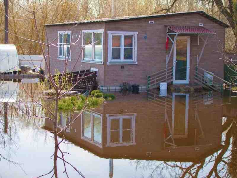
Living in or near flood zones brings extra questions about safety costs and paperwork. An elevation certificate measures and records how high a home sits above known flood levels so everyone works from real facts instead of guesses. Many people run into delays or extra fees because they do not have this document ready when they need it most.
Recording Building Height for Flood Review
An elevation certificate documents the height of a structure in relation to flood related reference data that local offices use to set rules. Surveyors measure the lowest floor foundation openings and surrounding ground then compare these numbers to official flood elevations. This shows exactly how much water would need to rise before it reaches the home and whether the site meets current safety standards.
These measurements tie directly to published flood maps so results stay consistent across different areas. The certificate lists exact heights for every key part of the building and notes which reference point the numbers come from. This creates a clear record that anyone can check later.
Helping Homeowners Understand Flood Documentation Requests
Lenders, insurers or local offices may ask for elevation records on flood prone home sites for very practical reasons. Banks want proof that a home meets safety rules before they approve a loan because flood damage puts their investment at risk. Insurance companies use the numbers to set policy rates and decide if they can offer coverage at all. Local planning offices need the document to issue permits for new work or changes to existing homes.
People often think these requests are just extra red tape but they serve a real purpose for everyone involved. Without verified height numbers each group would have to rely on rough estimates that lead to wrong decisions or unfair costs. Common reasons for these requests include:
- Buying or refinancing a home in a mapped flood area
- Applying for or renewing flood insurance
- Adding rooms lifting a foundation or changing the lot slope
- Verifying compliance before selling the property
Supporting Buyers Before Final Property Decisions
Buyers can use an elevation certificate to review flood related facts before closing so they know exactly what they take on. The document shows if the home sits high enough to avoid regular flooding or if extra work will be needed later. It also reveals whether current insurance rates will stay steady or jump significantly once the sale goes through.
This information lets buyers ask clear questions or adjust their plans if the risks feel too high. They can also compare the certificate against flood maps to see how the site compares to nearby properties.
Updating Elevation Details After Property Changes
Additions, foundation changes or missing records may require current elevation information to match what stands on the land today. Many older homes have certificates that reference structures or ground levels that no longer exist so the old numbers no longer apply. Lifting a home, building a new basement or grading the yard all shift key heights and need fresh measurements.
Sometimes records get lost or destroyed over time and no one can confirm the original data. An updated certificate fixes these gaps and keeps the paperwork aligned with the actual property. This prevents mismatches that cause delays or extra costs down the line.
Giving Reviewers a Certified Property Record
A licensed surveyor’s certificate gives decision makers a reliable document instead of informal estimates or personal claims. Surveyors follow strict rules and use calibrated tools so their measurements meet official standards. Lenders, insurers and local offices trust this document because it carries professional certification and clear proof of how the work was done.
Informal notes or rough measurements do not count for formal reviews and often get rejected immediately. A proper elevation certificate removes doubt and speeds up approvals because everyone sees the same verified facts.
Frequently Asked Questions
What is an elevation certificate used for flood prone homes?
It documents building elevation information that may be needed for flood review lending insurance or permits. It compares the home’s height to official flood levels so all decisions rest on verified data.
Can buyers ask for an elevation certificate?
Yes. Buyers may request one during due diligence for property in or near a mapped flood area. It helps them understand flood risks and future costs before they commit to the purchase.
Why would a homeowner need updated elevation information?
Records may be missing, outdated or no longer match the current structure. Changes like foundation work additions or yard grading also shift key heights and need new measurements.
Who prepares an elevation certificate?
A licensed surveyor or qualified professional prepares the certificate based on measured property data. They follow official standards so the document works for lenders, insurers and local offices.